About GPS DrivingRecorder Archive+
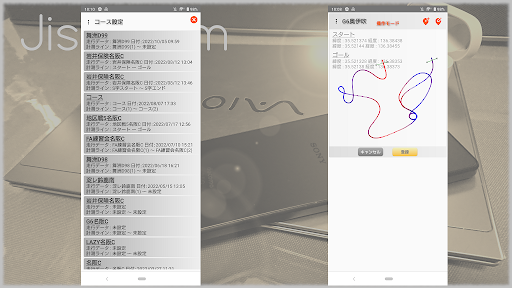
It is an application that records GPS position information and driving data such as speed,acceleration,roll,pitch,and temperature,humidity,road surface temperature,weather,road surface condition,and atmospheric pressure during driving for motor sports. The usage is here .. The recorded data can be checked on the viewer by combining the running trajectory with information such as speed,acceleration,pitch and roll. For temperature,humidity,and weather,weather information can be acquired and automatically set using the Internet (cancellation option function). The temperature and humidity can be set automatically in cooperation with the SwitchBot thermo-hygrometer. It can be edited directly by clicking on temperature,humidity,road surface temperature,weather,road surface condition,and barometric pressure. By connecting an external GPS sensor other than the built-in GPS as a pseudo-location service,it is possible to record a driving track with higher accuracy than the built-in GPS (DG-PRO1 is recommended). To select a course,tap Course (course name) to display the course selection screen,so select the course (course registration is required in advance).In the course registration,the measurement line can be set using the driving data (editing of the measurement line is a cancellation option function). By setting the measurement line,you can use the time measurement and the automatic measurement start function that starts measurement after passing the measurement line. Driving data,course,and measurement line can be deleted by swiping left.
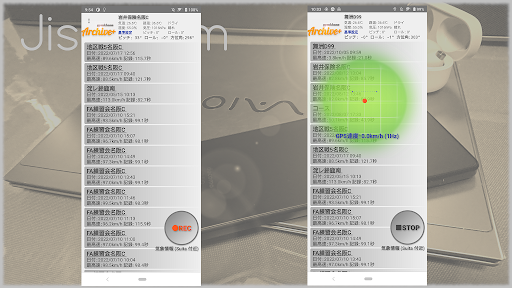
①Tap the course selection,temperature (TEMP),road temperature (ROAD),road surface condition,humidity (RH),barometric pressure (AP),and weather to enter.
(If it is linked with OpenWeatherMAP or SwitchBot thermo-hygrometer,it will be set automatically,so you only need to enter the part to be changed)
②Tap the standard setting (Since the current smartphone installation status is recorded,it is OK only at the time of installation)
③To use the pseudo location service,tap Launch Pseudo Location App from the menu.
④Click the REC button to start measurement.
⑤Click the STOP button to end the measurement.
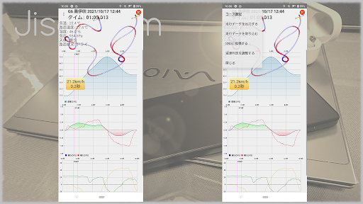
⑥Click the driving data to display the driving data confirmation screen.
Onthe confirmation screen,graphs of temperature,humidity,road surface temperature,weather,road surface condition,barometric pressure,driving locus,speed,acceleration,pitch and roll during driving are displayed. Various graphs can be pinched and trace the running trajectory.
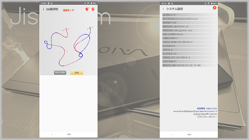
⑦ System settings (optional)
SPEED_CUT_FILTER (Specify the target speed (km / s or more) for driving data display in the range of 0.0 to 10.0)
ACTION (service name of pseudo location app)
PACKAGE (package name of pseudo location app)
DEVICE_MAC (MAC address of SwitchBot thermo-hygrometer)
G_SCALE (specify the graph scale ratio in the range of 0 to 10)
MEASURE_SWITCH (Specify the acceleration (G) at the start of measurement in the range of 0.0 to 0.5)
ALPHA (Specify the sensor input low-pass filter in the range of 0.1 (weak) to 0.9 (strong)
LPF (Specify the low-pass filter for graph display in the range of 0.1 (weak) to 0.9 (strong)
Additional App Information
-
Category:
-
Latest Version:3.10
-
Released on:Apr 12, 2022
-
Developed by:Jisei-firm
-
Requires Android:Android 8.0+
-
Available on:
-
Report:
